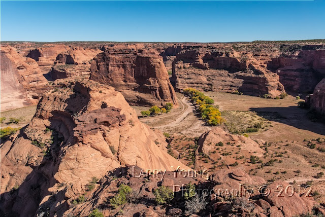
Desert View Lookout Grand Canyon

Desert View Lookout Grand Canyon

Friday, December 7, 2012

Jerome, AZ

In 1876 three miners staked claims for copper mining in the Black Hills near Mingus Mountain and established the town of Jerome.  The town was named in the honor of Eugene Jerome a principle backer in a new mining company called the United Verde Copper Company.  Although the area was very rich in Copper, the production and especially the transportation costs were very high and the company folded in less than two years. 


A new owner came along with a new vision of bringing a narrow gauge railroad to Jerome.  William A. Clarke laid tracks for a narrow gauge railroad that significantly lowered the costs of transporting the rich copper.  By the 20th century, the United Verde Mine was the largest copper producing mine in the Arizona Territory.  The town grew to boast two churches, an opera house, a school and several civic buildings.

In 1912, James Douglas developed the little Daisy mine and by 1916 Jerome had two bonanza copper mines.  Although the United Verde mine was larger, the Little Daisy mine produced better quality copper.  Production peaked by 1929, but the depression and other factors led to the demise of both mines.  The little Daisy shut down in 1938.


The Douglas Mansion you see in the photographs was built on a hill just above the Little Daisy mine and was designed as a hotel for mining officials and investors as well as his personal home.  It featured a wine cellar, billiard room, marble shower, steam heat, and a central vacuum system.  All of the adobe bricks that the house was constructed with were made on site.
Little Daisy Mine to the Left of Douglas Mansion

Looking East Towards Sedona


The Brothel

Tuesday, November 6, 2012

Petroglyphs and Pictographs

The Ancient Native Americans used Petroglyphs and Pictographs to describe their life.  It’s amazing how so many of these writings are still visible today.  Some of these drawings date back over 1000 years.

A Petroglyph is a drawing that has been etched with a sharp instrument into rock.  The best Petroglyphs were etched in the rocks where desert varnish is present.  Desert varnish is where the rock has been stained a darker color by water running over the sandstone.  By carving on the desert varnish they scratch the surface revealing the lighter sandstone beneath.  This photograph shows petroglyph.  The animals depicted are most likely Antelope.  Notice the Desert Varnish.  The Antelope on the right is running.  Probably being chased by hunters.


A pictograph is much more fragile because it is actually a picture drawn on the stone using primitive paints and stains.  This photograph shows a pictograph.  Notice the hand prints.  These are called positive hand prints because the paint was on the hand.  Notice the hand print on the left below the Kokopelli.  This is a negative hand print because the paint was applied around the hand.  It is not completely known why hand prints are so prevalent, but Archaeologists believe they are a symbol that represent the owner of the print, similar to a signature.  Back to the Kokopelli.  A Kokopelli is a symbol for harmony.  It is a person playing a flute.  This guy was in a full state of harmony.  He is on his back.  Notice just above and to the right of Kokopelli.  This symbol may be a frog because of the three toes, but it could also be an image of a warrior with arms in the air meaning, "stay away".  Arms down would mean welcome.


In this photograph there are many figures.  Positive and negative hand prints, full moon, small animals  etc.  Those of you in Mrs. Hanson's class, how many can you identify?  A good web site to explore for answers is http://www.warpaths2peacepipes.com/native-american-symbols/dictionary-of-symbols.htm 


Thursday, November 1, 2012

Chanyon de Chelly National Monument

Canyon de Chelly (D-Shay) is a very beautiful canyon with two forks and magnificent stands of Cottonwoods.  The lower canyon (southern) is named Canyon de Chelly and the upper (northern) is named Canyon Del Muerto.  The canyons can be entered by car from a very non-descript dirt road that suddenly turns to deep fine sand.  Unless you have the skill of the Navajo guides, you will get stuck no matter what kind of 4 wheel vehicle you have.  In fact it is illegal to enter the canyon without a guide except for a trail that leaves the South Rim Drive and descends into the canyon to go to the White House Ruins.  If you take that trail, you can only see the ruins and must return to the top the same way you came down.  By the way, at that point it’s about 700 feet down.  When you enter the canyon, the canyon walls are only about 30 feet high, but buy the time you get to the Spider Rock formation; they are over 800 feet high and eventually get to over 1000 feet above the canyon floor.

Archeological evidence shows that people have lived in the canyons for nearly 5000 years.  The first people to come to the valley were called Archaic.  They were the hunters and gathers.  Canyon de Chelly provided an abundance of small and large animals for food.  About 2500 years ago, a group of people came to the canyons called Basketmakers.  These people had additional skills like weaving and farming.  Basketmakers rock drawings show a society of extended families growing and storing food and engaging in religious activities.  After the Basketmakers, (about 1250 years ago) a group of people called the Pueblo Indians came to the canyons.  The Basketmakers lived in dispersed hamlets; but the Puebloan people developed a new kind of settlements called villages.  Why, is unclear, but it could have been for defense purposes.  These people grew Turkeys for food and harvested cotton for weaving.  Puebloan life ended about 700 years ago and these people left to establish villages along the Little Colorado and the southern tip of the Black Mesa, and later to become known as the Hopi.  The Navajos now occupy the canyons and still farm them today.  They grow cotton, corn, fruit, sheep, and other crops.


Although Canyon de Chelly is very beautiful, it is scared with a legacy of death and destruction brought on by the U.S. Military.  In 1863 Kit Carson was commissioned as a colonel and discharged with the duty to massacre every Navajo he could find.  In the winter of 1864 kit Carson entered the eastern end of the canyon and pushed the Navajos toward the mouth of the canyon.  Killing women, children, men, and animals, destroying all crops, Hogans, and anything else that the Navajos held dear.  The massacre was immense.  Later in the spring, he came back again and killed or took capture anything that was left.  Any Navajos that were taken prisoner were forced to march over 300 miles to Fort Sumner in New Mexico territory.  Scores perished from thirst, hunger, or fatigue.  Many of those that survived the “Long Walk” later died at Fort Sumner because of poor food, shelter, and disease.  In 1868 the few remaining survivors were released and allowed to return to the canyon a rebuild their lives.

We were very fortunate to hire a Navajo guide who actually lived and worked the canyon.  His name is Ben.  He is an older gentleman about 70 years old.  He is a 4th generation Navajo farmer of the Canyon Del Muerto.  In fact, he even took us up to the property he farms with his siblings.  This was one on the most interesting 3 hours I have every spent with an individual.  Because it was just my wife and I, were we able to get some very personal and insightful information.  He told many fascinating stories of crowing up in the canyon.  One was of his mother weaving cotton to make rugs to sell at the trading post in Chinle.  If he was a good boy and did not play in the Anasazi ruins behind their home, and did his chores, he was rewarded with the opportunity to make the trip into Chinle and maybe get some chocolate.  Mind you, the trip to Chinle was over 5 hours one way.  Now it takes about 30 minutes by car.  Ben not only farms his past generations land, but also conducts tours of the canyons.  In a day he makes 3-5 trips in and out of the canyon.  Also keep in mind, this is no easy task.  He is a very skilful sand driver.  It is inconceivable to me how he can spend so much time driving in that sand and not get stuck.  I guess it’s like a bird flying.  Second nature for the bird, but don’t you try it.  I asked how do you keep people out without guides, because anyone can just drive in.  He said it’s not really an issue because they never get more than a quarter of a mile before getting stuck.  He told of a couple in a 4 wheel drive pickup that was stuck in the morning when he took his first tour.  They were trying to dig their way out.  When he came back three hours later, they had gotten out and made it about 100 yards farther, but were stuck again.  On his second tour of the day, when he went by they were stuck again.  Three hours later he found them trying to get out of the canyon, but stuck again.  He said they never made it more than ¼ mile into the canyon.  They had spent the whole day and only got ¼ mile.


White House Ruins
Some of his ancestors were ones forced to make the Long Walk.  His stories made it very real for me.  The history and dedication is fascinating.  If you ever get to Canyon de Chelly, ask for Ben Anagal at De Chelly Tours.


Spider Rock


Ruins Behind Ben's Farm

Pictographs


Kiva in Center


The Grainery is on the Left

White House Ruins

Lower White House Ruins


Some of Ben's Farmland on the Left


Our Campground

Sunday, October 28, 2012

Monument Valley

Monument Valley is actually a beautiful mesa.  Located at about 5600 feet elevation, it has a very rich history in early American development.  It is a very windy place and the wind is what has carved the magnificent pinnacles and mesas.  The valley was once a plateau 1000 feet high.  The wind has carved out the softer sandstone leaving the harder rock.  The state line of Arizona and Utah passes through Monument Valley Navajo Tribal Park.  However, it is entirely with the Navajo Nation.  To enter the park you must pay the $6.00 per person Navajo Land Use Fee.  There is a visitor center and a very popular and very expensive motel.  The motel has a commanding view of the Mittens and other formations.  There is a 17 mile drive that you can drive in your personal car into the park.  Be aware the “road” is very rough, dirt, sand, steep, rocky and generally a car destroyer.  It’s best you have a high clearance vehicle.  We have a 4 wheel drive 1 ton truck, but we chose to hire a guide to get the best experience and save my truck.

Our guide was Marie.  She is a native Navajo who had been leading tours for 16 years.  There were about 10 people on our tour.  Another ride in an old pickup modified to carry people.  At least this one had old school bus seats.

We began tour of a Navajo Hogan (Hoe-Gan') hard second syllable.  A Hogan is an eight sided structure made of Juniper logs and covered with mud.  It has a dirt floor and a chimney in the center.  The door always faces east to the rising sun.  A Hogan with a round roof is a “Female” Hogan.  If it has a pointed roof it is a “Male” Hogan.  Although the Hogans are either male or female it does not mean the natives occupy one or the other.  It just means the Hogan is male or female.  Go figure.  The picture of the Navajo spinning yarn for a rug was taken inside the Hogan.  Her name is Lucy and she like gratuities.

After visiting Lucy, we headed into the valley of many formations.  Our guide led us to ancient drawings, dwellings, and movie sites.  Because we had a guide we were able to visit many sites not open to the public.  We visited many old movie sets like John Ford’s Point.  Some of the more famous movies include, She Wore a Yellow Ribbon, Kit Carson, Fort Apache, The Eiger Sanction, Back to the Future, Billy the Kid, and many others.

The valley was originally inhabited by the Anasazi 1500 years ago.  After the Anasazi left, the Navajo and Hopi moved in and occupy the valley.  Today, the traditional Navajos do not have electricity or running water.


Monument Valley was relatively unknown until the late 1930s.  At the end of the First World War Harry Goulding and his wife “Mike” Goulding came to Monument to live with the Indians.  In the 1924 they established a trading station where the natives could exchange their livestock and handmade goods for other necessities.  The Gouldings loved and respected the Navajos.  They established a hospital, brought in fresh water, and brought tourists.  The Gouldings were instrumental in bringing Hollywood to the valley.  The first movie Stagechoach  was filmed in 1938.  Soon the world became fascinated with Monument Valley.  The Gouldings further developed the valley creating a grocery store, motel, schools, and a campground, to bring more tourists and further enhance life for the Native Americans.  Other than the visitor’s center the only other service available in Monument Valley is at the Goulding complex.

Natural Bridge
John Ford's Point
Ancient Carvings
Sentinel Mesa and Right Mitten


Window Rock