Many don’t know that Folsom was the terminus for the Pony Express from June 1860 to June 1861. The riders left their horses and traveled to Sacramento on the Sacramento Valley Railroad (SVRR). In fact, Folsom was the “hub of the west” during that time. Many people traveled on ships around Cape Horn, to San Francisco. They then boarded a ship and traveled up the river to Sacramento, and then boarded the SVRR to Folsom. Wow! What a way to get to Folsom. From Folsom they continued their journeys to the gold fields in Coloma, Auburn, Placerville, and other gold rich towns. Folsom was a very popular place in the mid 1800s and became a passenger Mecca. At its peak, Folsom had twelve stage lines connecting to various communities in the foothills.

In May of 1854 Theodore Judah arrived in California to start construction on what he considered to be the first transcontinental railroad. The first phase was to go from Sacramento to Negro Bar. Negro Bar was an encampment on the American River near the area where Folsom is located today. The Negro Bar encampment later grew to become the township of Granite City, then in 1856 the name was changed to Folsom in honor of Capt. Joseph Libby Folsom. Grading for the railroad began in February 1855 at a location that is now Front & L streets in Old Sacramento. On August 8, 1855 the first tie was laid. Only ten short days later, the first engine was fired, and on August 20, 1855, the first excursion train departed Sacramento. On February 1, 1856, the line was completed to Folsom. Rail from Folsom to Lincoln was added in 1861 and another line from Folsom to Latrobe was added in 1864. Unfortunately, plans for a line to go from Folsom to Marysville never really materialized. Judah's original estimate of construction costs for the Sacramento-Folsom rail line construction was $43,500 per mile, and the contract had been let for $45,000 per mile. However, when the railroad had been completed to Folsom, it was discovered that the cost had actually been $60,000 per mile. Thus, it was determined that the cost to continue beyond Folsom was too high and construction stopped at Folsom.


Also, in 1856, the first of two turntables (possibly three) were built in Folsom. The turntables were used to turn the trains around for the trip back to Sacramento. The first turntable was a deck-type table 40 feet long with a five to six foot pit. The walls of the pit were constructed of local bricks. Eleven years later, the deck-type turntable was replaced with a longer “A” frame style table that eventually was fifty-six feet long. Between 1867 and 1913, this turntable was reconfigured at least once to achieve its fifty-six foot length. In fact, one year later after the second turntable was built it was reported that yet another turntable was built near the SVRR carpenter shop. So, for a short time Folsom had two operating turntables. It is hoped that future excavations will reveal the true location of that second turntable. When the Folsom “wye” was installed a turntable was no longer necessary to turn the trains and the turntable was dismantled and filled in. Doug Hays rediscovered the old turntable pit in 1975, but it was not until 1995 that it was properly unearthed. With the help of Mr. Kyle Wyatt and Mr. Wendell Huffman of the Nevada Museum, a replication of the 1867 “A” frame turntable was completed in September of 1999 and now serves as a focal point in the Folsom Railroad District.
+copy.jpg)

The Sacramento-Folsom line became the first commercial railroad west of the Mississippi. As a result of the 22 mile Sacramento-Folsom line, laws were passed that eased railroad financing and opened the door for the first transcontinental railroad. Folsom was going to be the start of the big climb over the Sierras. Unfortunately, Theodore Judah later became Chief Engineer of the Central Pacific Railroad and determined that the Central Pacific Railroad should be routed through Roseville and Dutch Flat to make the climb over the Sierras.
In 1863 Theodore Judah went to the Far East to seek investors for his railroad. Crossing the Isthmus of Panama, Judah contracted malaria and died in New York at the young age of 37.
On April 19, 1877 the Sacramento Valley Railroad was consolidated with the Folsom and Placerville Railroad to form the Sacramento and Placerville Railroad. In 1877 the Placerville and Sacramento Valley Railroad was also deeded to the Sacramento and Placerville Railroad. The new railroad operated over 49.1 miles of track between Sacramento and Shingle Springs.
View map of the Folsom-Placerville rail line:
http://www.abandonedrails.com/map.asp?c=815
The American sprit to endure extremely challenging circumstances for a better life was a foundation for development of the “wild west” and the early railroads played a very significant role. Towns lived and died by the railroad. If the railroad bypassed a town, the town would have a very difficult time surviving. An example would be the town of Clarksville just outside Folsom. Clarksville was a thriving town in the mid 1800s. It even had a Pony Express stop. But shortly after the Folsom Placerville rail line bypassed Clarksville on its way to Latrobe, the town slowly died and is now considered a ghost town. The Township of Mormon Island in its heyday had a population of over 2,500. It boasted a post office, four hotels, seven saloons and about fifteen other businesses. It was considered a natural stopping point for its two stage lines running from Sacramento to Coloma and Sacramento to Mormon Island and back. Mormon Island had tent school, what many consider to be the first school in Gold Rush country. The completion of the Sacramento Valley Railroad in 1856 and its termination at Folsom, marked the beginning of a long decline for the once important town. Mormon Island gradually decreased in importance and by 1880; the population had dwindled to zero.

Other large communities near Granite City flourished in the mid 1800s. Prairie City by 1856 had a population of 2,000 and was larger than Granite City (later that year to be renamed Folsom). Before Folsom had its own school, children living in Folsom were sent to Prairie City to study. By 1865, all the gold around Prairie City had been worked out, and the town was gone. Now all that remains is a plaque on a stone marker. Salmon Falls was a mining community on the American River and the junction of Sweetwater Creek. By 1850 it had a population of 3,000. Now nothing is left of the town and most of the time it, and Mormon Island are under water formed by Folsom Lake.
Map coordinates of abandoned towns listed:
Start of the SVRR in Sacramento: 38°34.887’ W 121°30.406’ W
Mormon Island: 38°.7035’ N 121°.1174’ W
Salmon Falls: 38° 45’29” N 121° 03’30”W
Prairie City Marker: 38° 38’39.47”N 121° 09’25.91”W
Clarksville: 38° 39’22.39”N 121° 03’00.37”W
Negro Bar Encampment: 38° 40’30.67”N 121° 11’14.36”W
Sources:
Folsom History Museum
Internet Research
Footwork
Image discriptions:
Folsom-Placerville tracks near the Old Payen Ranch.
38° 36.821’ N
121° 4.350’ W
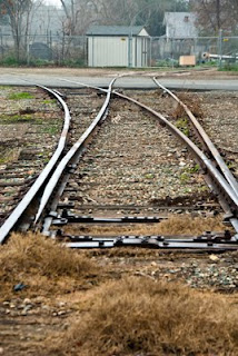
Folsom-Placerville Railroad tracks near the Folsom wye.
38° 40.458’ N
121° 10.958’ W
Reconstructed turntable in Old Town Folsom today.
38° 40.588’ N
121° 10.771’ W
Folson-Placerville tracks near Glenn Drive, Folsom
38° 39.736’ N
121° 10.447’ W
Folsom wye.
38° 40.076’ N
121° 10.954’ W
Reconstructed turntable in Old Town Folsom looking toward the new parking garage.
38° 40.588’ N
121° 10.771’ W
The long post at the end was used to turn the turntable by hand. Normally there were many people on hand to greet the train and eagerly pitched in to turn the train.
38° 40.588’ N
121° 10.771’ W
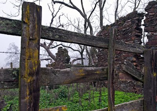
Remains in the now abandoned Clarksville
38° 39.301’ N
121° 3.094’ W
Remains in the now abandoned Clarksville
38° 39.301’ N
121° 3.094’ W
Old rock wall in Clarksville.
38° 39.301’ N
121° 3.094’
Remains of a rock building in Clarksville.
38° 39.301’ N
121° 3.094’ W
House in Clarksville.
38° 39.301’ N
121° 3.094’ W
House in Clarksville.
38° 39.301’ N
121° 3.094’ W
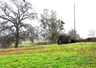
Sweetwater Creek just before it enters the South Fork of the American River. It was here that the mining community of Salmon Falls was located. The bridge in the background is the last of three bridges that were built on this site. The first two were wiped out by floods. I believe this bridge was built about 1883.
38° 45’29’ N
121° 03’30” W
Salmon Falls bridge. This bridge, the townsites of Salmon Falls and Mormon Island are all under the waters of Folsom Lake. They only become visible during drought years.
38° 45’29’ N
121° 03’30” W


 California’s first contact with Europeans began in the mid 1530s, but it was not for more than 200 years did Spain seriously attempt to gain control of Alta California. It was not until 1769 that the first parties set forth from Baja California with priests and soldiers. They established the presidio and a mission at San Diego. Eventually, there would be three more presidios (at Monterey, San Francisco, and Santa Barbara) and a total of twenty-one missions. These missions introduced Christianity to California, but they also introduced new diseases that the local tribes had no resistance. Due to crowded living conditions in the missions, thousands died of epidemics, and the infant mortality rate and death rates among young children soared. The population of the Native Americans was cut by half to about 150,000. Most that survived were the non-mission natives like the Modocs that lived in the northern mountains and had little or no contact with the Spanish.

 Sutter needed lumber to build his fort and his partner James Marshall knew just where to get it. He took some of the Mormons to Coloma and they finished the sawmill needed to process the lumber in January of 1848. Next they set out to deepen the streambed so the millrace would have adequate power. On January 24, 1848, Marshall went down to the river to inspect the progress....


+copy.jpg)


